On March 8 and 9, we’ll stroll around Franklin Park to see if we can sort out the three phases of development that Alameda historian Woody Minor describes. The first wave began with the building of a home in Franklin Park in the 1860s. Reliable transportation did not exist here until the 1864 arrival of the first trains. The transcontinental railroad rolled through town in 1869, no doubt attracting outside attention to the sleepy peninsula.
A second train arrived in 1878, rumbling along Central Avenue at the neighborhood’s doorstep. Both these railroads and their accompanying ferries opened Alameda to the outside world.
The coming of the Alameda, Oakland & Piedmont Railway electric streetcar in 1892 encouraged the second groundswell of development, which Minor dates from “about 1890 to about 1910.” Minor calls this wave the Gold Coast’s “classic” phase. He notes that this period lent the neighborhood “an architectural character derived from the prevalent styles of the era.”
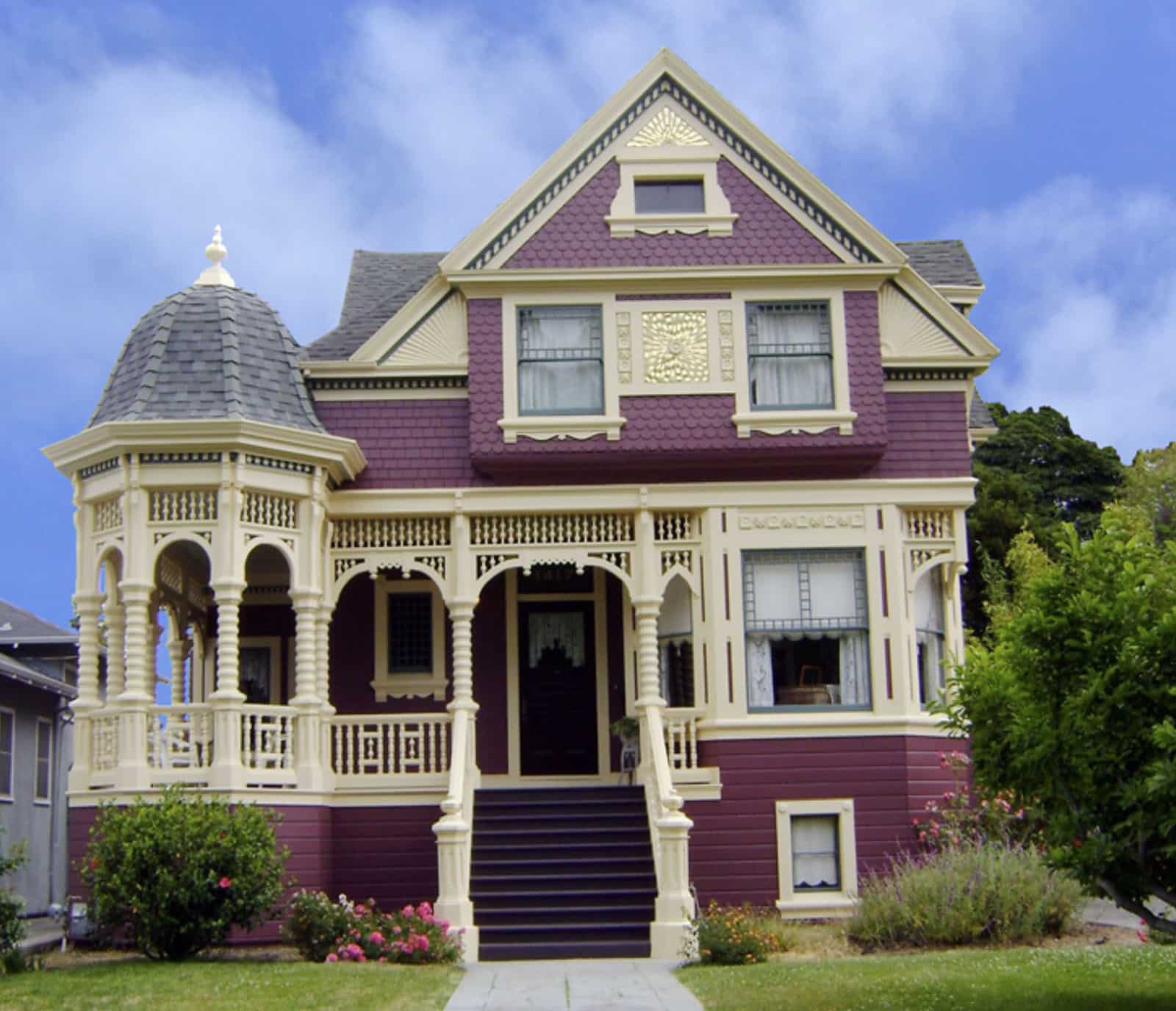
He cites the Queen Anne, Colonial Revival, and Craftsman styles as examples of homes that we’ll see as we explore Franklin Park, San Antonio Avenue, and Bay and Sherman streets.
The Roaring ‘20s brought the bungalow to town. These smaller homes, with conveniences like indoor plumbing and electricity included in the price, played an important role in the final wave of development in the 1920s. Minor reminds us that homes built during this third period include a number of revivalist styles. These incorporate the Tudor Revival, inspired by homes in England; the Mediterranean Revival with its roots in colorful Italian creations; and Spanish Colonial with their white exterior walls, red clay tile roofs and ornamental iron work.
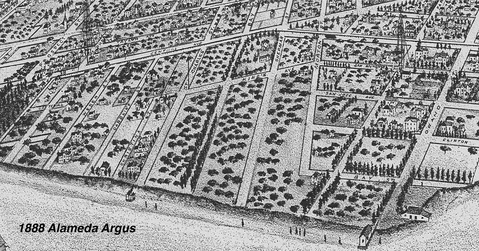
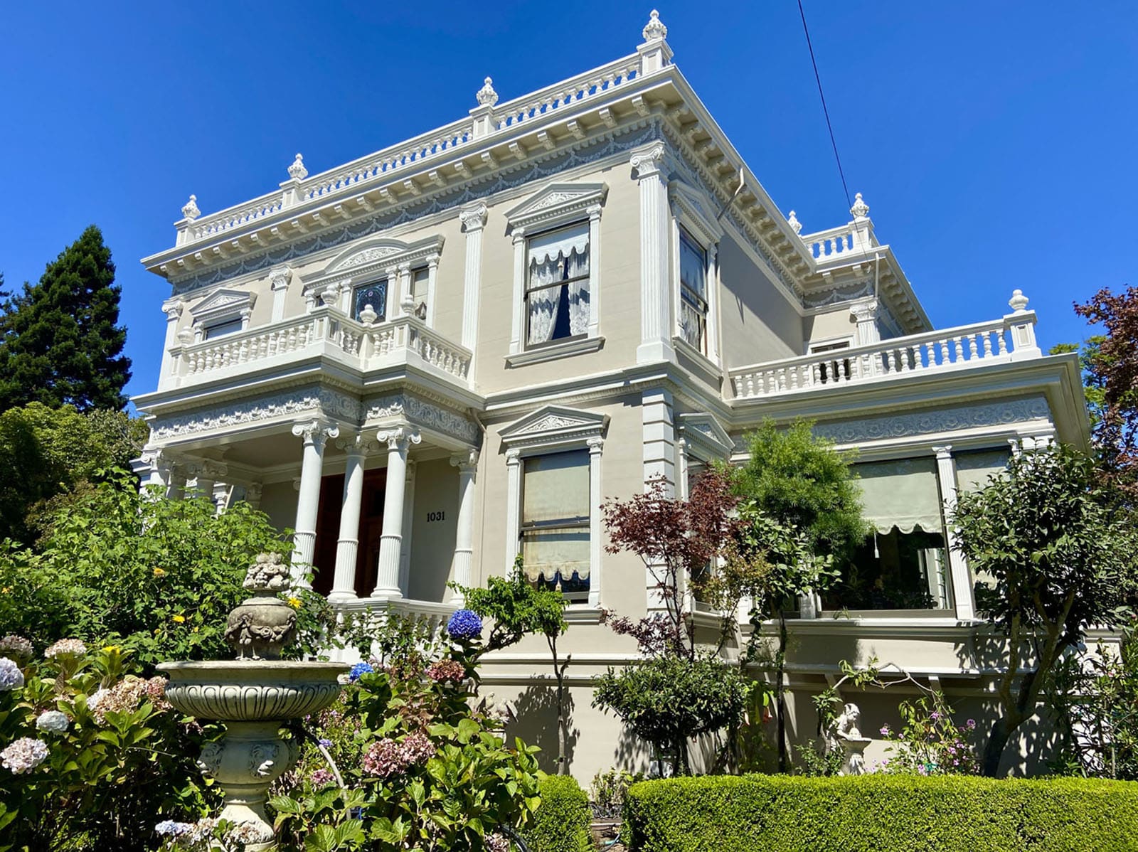
During our second Gold Coast walk, we’ll learn how the Alameda, Oakland & Piedmont streetcar system created a way through today’s Gold Coast. We will see Thompson & West’s maps of Alameda that show the Gold Coast’s original tracts, which include Oak Park, Teutonia Park, and Encinal Park. A look at these now-forgotten tracts will be featured in the PowerPoint presentation beforehand as well as on our walk. The handout for these walks will provide an interesting 1888 “aerial” view of the entire neighborhood from the Alameda Argus map. We’ll meet Charles and Eliza Baum, whose home along San Antonio Avenue at Morton Street set the stage for the development of today’s Gold Coast.
A. Cohen’s San Francisco & Alameda Railroad began running its trains along today’s Lincoln Avenue in 1864. This train and its wharf, located about where the USS Hornet is docked today, may have encouraged the Baums to live here. They were wealthy enough to have a coachman and two domestic servants in their household. I can picture them leaving their home in their coach headed for, perhaps, Mastick Station.
Until 1872, Charles and Eliza could ride the train to the wharf in Alameda and arrive in San Francisco aboard one of the ferries that served Cohen’s railroad. After 1872, trains carried passengers and goods down today’s Wilma Chan Way across first the Alice Street Bridge, later the Harrison Street Bridge.
We’re not sure when the Baums moved here, but the 1870’s enumerator (census taker) Stephen Burpee found Charles and Eliza living in Alameda with their children Rudolph, Agatha, Alex, and Virginia. Homes had no addresses yet. Burpee also noted coachman Tim Gainy and domestic servants Anna Housa and Catherine Bauch living at the home. The 1880 directory lists the home at “San Antonio and Morton.”


This year, the Alameda Post begins its walking tour season exploring the neighborhood we know as the Gold Coast. We will cover the history and architecture of the neighborhood and learn about the notable architects who designed and built homes here, including Marcuse & Remmel, Delanoy & Randlett, Wasson & Pattiani, and Ernest Coxhead. Builders George W. Scott, David S. Brehaut, and Peter Christensen also plied their trades in the neighborhood.
To prepare you for each tour, Dennis will present a short—one hour or less—illustrated lecture before each set of tours to provide additional context. This lecture is optional, and you can enjoy and learn from each tour even without viewing the introductory presentation. The link to watch each lecture will be sent to ticket holders before each tour.
Each tour meets at the time, date, and location stated and will end where it started. Each walk will cover 90 to 100 minutes over one to two miles. We suggest you wear comfortable shoes as well as sunblock and bring water. Mobility devices, strollers (kids under 6 are FREE!), and well-behaved (or especially cute) dogs are always welcome.
March 8 & 9, 2025 – Gold Coast: Franklin Park to Bay Street
Our first walk will introduce you to the streets that embrace Franklin Park: Paru and Morton streets and San Jose and San Antonio avenues. As we walk down San Antonio Avenue, we’ll visit Sherman and Bay streets. We’ll stop and discuss the style and features of many of the homes along the way.
Tickets are $20 each. We will meet at 10 a.m. on Saturday, March 8 or Sunday, March 9 at Franklin Park, San Antonio Avenue & Morton Street. More info.
March 23 & 29, 2025 – Gold Coast: St. Charles to Caroline
Next, we will show off the Gold Coast’s “West End” this month. Caroline Dwinelle and Emile Kower developed this area as “Encinal Park.” We’ll check out some magnificent homes on Caroline, Weber, and Hawthorne streets. We will also uncover some personal details about some of the people who lived in these historic homes.
Tickets are $20 per person for each tour. We will meet at 10 a.m. on Sun. March 23 or Sat. March 29 at the corner of St. Charles Street & Fair Oaks Avenue. More info.
The first ripple of serious residential development began in the late 1870s and early 1880s. “Those early Gold Coast houses, which included half a dozen mansions on Grand Street and several others along the shoreline bluffs, set the tone for the area as an abode of prominent families in fine homes,” Woody Minor writes.
As we walk along, we will learn about the later arrival of Ranch-style homes, which date after the third wave had retreated, mostly from the 1930s to the 1960s. We’ll also take a walk down San Antonio Avenue and visit Bay and Sherman streets along the way. On our second Gold Coast Walk, we will explore the streets to the west, some created to make up the now-forgotten Encinal Park Tract.
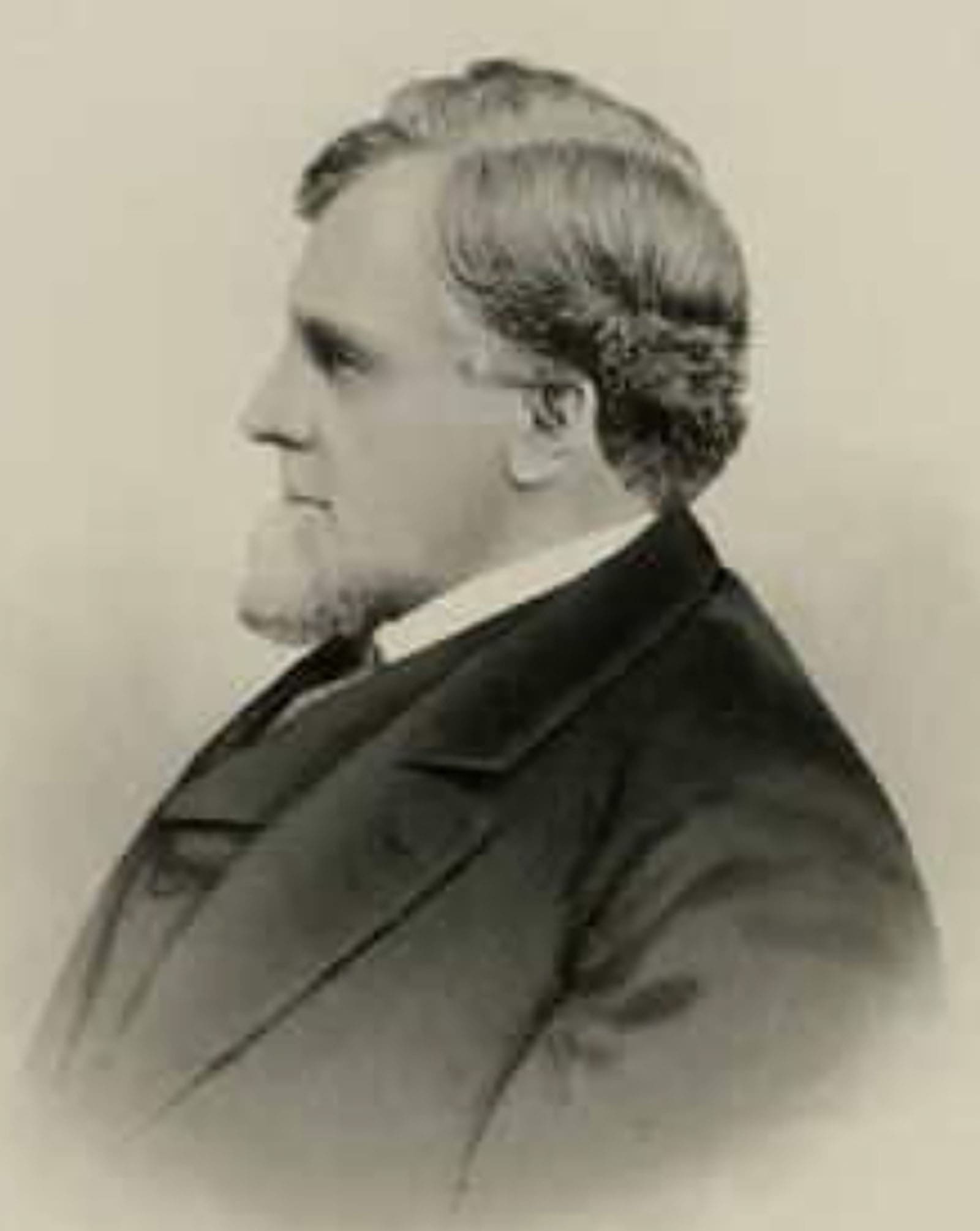
Alameda created Franklin Park in 1923 as the City’s fourth park. Charles Tilden sat on the City Council at the time. He lived nearby and played a crucial role in creating the park. Charles Baum passed in 1888. Eliza lived here until her death in 1919. The City purchased the Baum property from the children in 1922 and incorporated it into Franklin Park. The City took down the Baum home and two other homes along Paru Street to create the park.
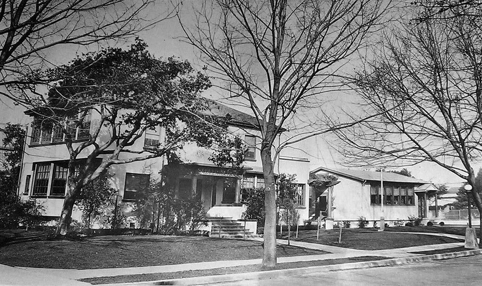
One of those homes was a remodeled cottage that served as the first Franklin School. In 1930, the school district purchased the Sadler family home across from the park on San Antonio Avenue near Paru Street, remodeled the building, and renamed Franklin School to “Sadler School.” Sadler Elementary taught neighborhood children for more than 20 years. In 2023, the school’s 1938 kindergarten class earned the Guinness World Records title for the longest running class reunion. They had been meeting every year without fail for 83 years. In 1951, the school district replaced the 1930 structure and renamed Sadler School for Benjamin Franklin.
And speaking of names, the City had named its first four parks for presidents—Andrew Jackson, Abraham Lincoln, William McKinley, and George Washington. Tilden, who lived on San Antonio Avenue near the new park, insisted that the City name the grounds for Benjamin Franklin rather than naming it for either Ulysses Grant or James Garfield as some had suggested. The City agreed and this broke the precedent of naming parks for presidents. Tilden went on to serve as a president of the East Bay Regional Park District’s board of directors. Tilden Way and Tilden Park in the Berkeley Hills were named in his honor.
As we stroll down Sherman and Bay streets, we’ll visit the site of the oak forest that stood when Mary Fitch subdivided her property in a very unusual way.
We’ll continue our walk with a look into some interesting development stories. Why does Morton Street extend south of San Jose? Why did it take so long to develop the west side of Sherman and the east side of Bay? Why do address numbers on Sherman and Bay streets change from 1200 to 1100 with no intersection at the change?
Join us on our walks this month to learn all this and more.
Dennis Evanosky is the award-winning Historian of the Alameda Post. Reach him at [email protected]. His writing is collected at AlamedaPost.com/Dennis-Evanosky.

