As we made our way down the road Life magazine once called “The Loneliest Road in America,” we weren’t feeling very lonely, but we’d found lots of natural beauty, history, unusual sights, and even a plague of Mormon crickets. In Part 1 of this series, we got started at Donner Lake—site of an 1846 overland adventure that ended in tragedy—before crossing the border into Nevada and joining Highway 50, the road they call the loneliest. A pilgrimage to a tree covered in shoes, a visit to an abandoned stone castle, and a night camping near 10,000-year-old petroglyphs rounded out Part 1.
Highway of adventure
Part 2 found us driving over thousands of Mormon crickets, as their migration across northern Nevada caused road accidents and “biblical plague” levels of infestation in the region. We also visited the “Friendliest town on the Loneliest Road,” Eureka, where a shopkeeper gave us a glimpse of the town’s historic underground tunnel system that once connected all the downtown businesses. Pulling into Ely for a ride on a steam train of the Nevada Northern Railway, we got to meet the famous railway cat, Dirt Jr., mascot of the historic railroad.
Reaching the summit
In Part 3, we achieved a long-standing goal, which was to climb to the summit of Wheeler Peak, elevation 13,065 feet, and savor the spectacular views from the mountain we had failed in our attempt to climb four years ago. After that peak experience, the question was, what next? Our friends were heading off towards Canada to continue their adventures, and Edie and I still had the rest of the week to get back to the Bay Area.
A fork in the road
At this point, we could have backtracked on Highway 50 to take the most efficient route home, perhaps with some stops to see things we had missed on the way out. A more exciting possibility, though, was to head south on Route 93, the “Great Basin Highway,” and take a longer, more southern loop home. This would involve heading into some hotter temperatures—reaching 100 degrees or more—but it also promised even more open roads and fascinating sights.
Leaving the lonely road behind
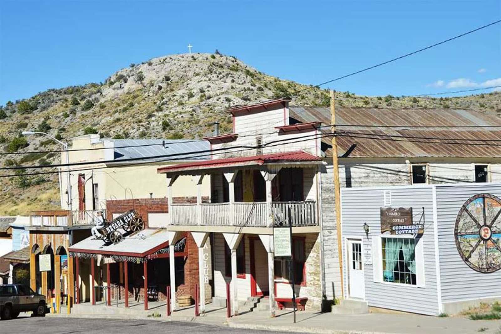
Having made our decision, we left Highway 50 and headed south on Route 93, the Great Basin Highway. It was more than 81 miles to the next town, Pioche, so this was a pretty lonely road too. But if lonely means wide open spaces, beautiful high-desert scenery, mountains, valleys, and no traffic, we’ll take it. We stopped for gas in the old mining camp of Pioche, described on the town’s website as “a small, picturesque town clinging to the side of a mountain in Nevada’s high desert, roughly 180 miles northeast of Las Vegas.”
Pioche (population 1,100) is the kind of town where, in retrospect, I wish we would have spent more time. Dramatically set on a hillside, it has a windswept, frontier look that didn’t seem that far off from its wild west days. Known as one of the roughest camps in the west in the 1870s, it is said that 72 men were killed before anyone died of natural causes there. Old 19th century buildings line the main street, and actual tumbleweeds blew by as dust and grit blew into our van when we opened our doors at Tillie’s Gas and Mini Mart on Main Street. But between the intense wind and the fact that we were anxious to get 10 miles down the road to Cathedral Gorge State Park, in hopes of finding an open campsite and taking an afternoon hike, we decided to keep moving. I’ve got Pioche on my list of places to see next time we pass this way, though. I find that traveling doesn’t necessarily check things off the list, but rather, it expands the list with more things to see next time.
Cathedral Gorge
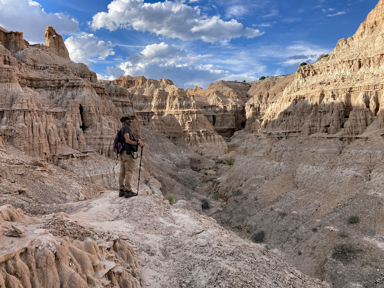
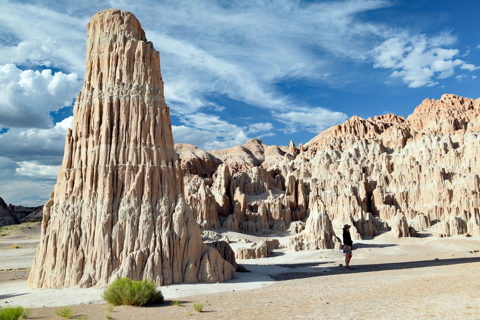
Arriving at the overlook point just north of Cathedral Gorge State Park, we stepped out of the van and were greeted by a temperature of over 100 degrees. Looking for a place to have our lunch out of the blazing sun, we found a spot under a shady tree overlooking the otherworldly landscape below. A sea of sculpted siltstone spires spread out before us, in stark contrast to anything we’d seen on this trip thus far. It looked like something you’d expect to see in the Canyonlands of Utah and Arizona.
An ancient lake once existed here, and over the past million years, as the climate became drier and the land uplifted due to geologic forces, the waters drained away. As the Meadow Valley Wash and its tributaries cut deeply into the silts of the lake bottom, the spectacular “badlands” terrain of Cathedral Gorge slowly formed. As we sat eating our lunch and taking in this scene, I tried to comprehend the sheer amount of time and natural forces it took to create the landscape we were seeing.
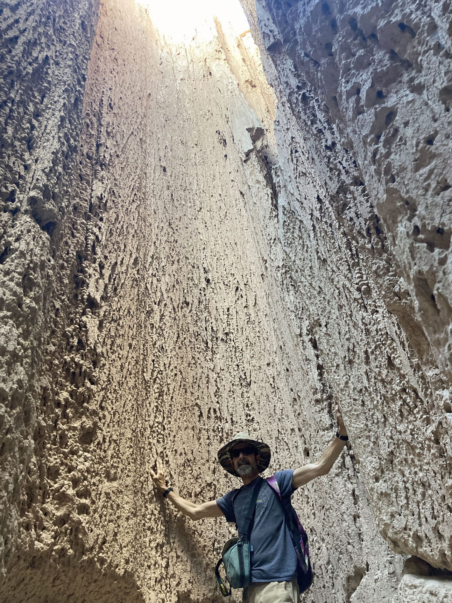
Despite the intense heat, there were a number of people staying at the campground, although most seemed to be inside their campers with the air conditioning on, waiting for the cooler evening temperatures. Not us, though. Edie and I stocked up on water and headed out to do some hiking. In a place this beautiful, we couldn’t afford to waste any time not seeing and experiencing as much of it as we could.
One of the most memorable aspects of our stay at Cathedral Gorge, aside from the striking natural beauty of the desert and its sculpted spires, was an intense thunder and lightning storm that blew in that night. After dinner, as we sat in our chairs taking in the peace and quiet of the landscape and enjoying the cooler temperatures, we could see lightning flashing all around us, seemingly far in the distance. So far in fact, that we couldn’t even hear the thunder. Over time though, the wind picked up and the lightning appeared to get closer, along with the rumbling thunder. Once we were tucked inside our campervan for the night, the skies opened up with torrential rains, deafening bolts and crashes of lightning, accompanied by instantaneous blasts of thunder. There was no delay between the flash of lightning and the explosion of thunder, meaning the storm was making a direct hit on Cathedral Gorge. It was a little scary and very exciting at the same time. Who doesn’t love being inside a warm and snug place while nature lets loose with all its fury just outside?
The next morning, the desert looked a little wet in places, but overall it looked like it hadn’t even rained. That’s how quickly the arid landscape absorbs any amount of moisture it receives.
Oldest town in eastern Nevada
After a morning hike in Cathedral Gorge, it was back on the road again, heading down Route 93 until the turnoff to Panaca, known as the oldest surviving town in this region of the state. The name Panaca is derived from the Southern Paiute word “Pan-nuk-ker” which means metal, money, wealth. Founded by Mormon missionaries and settlers in May 1864, the town was once part of Utah territory, but became part of the state of Nevada in 1866 when its eastern border was revised. At that time, some of the settlers left town in order to remain in Utah, but to this day, many of the residents of Panaca are descendants of those original settlers. Today, Panaca is a quiet and peaceful agricultural town of about 1,000 people, and is one of only two places in the state where gambling is prohibited.


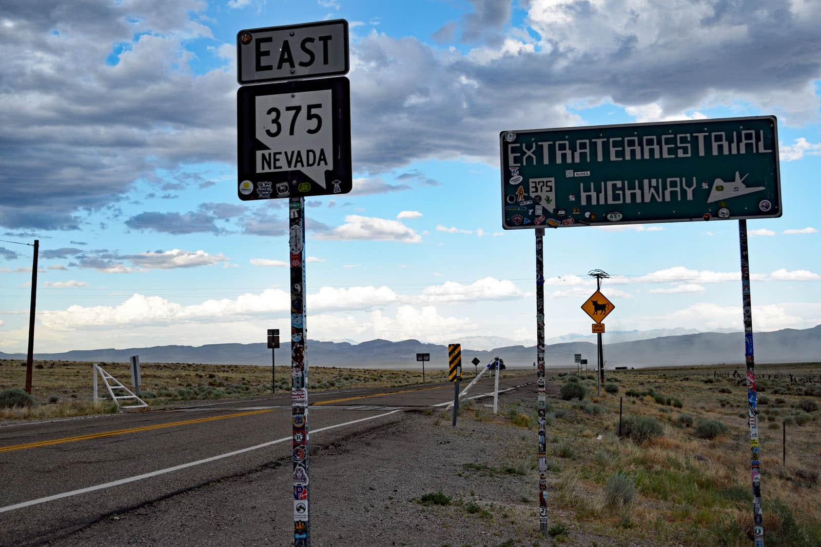
The Extraterrestrial Highway
After exploring the old railroad town of Caliente, named after a nearby hot springs, and taking another hot but beautiful hike at nearby Kershaw-Ryan State Park, we turned east on Route 93 near the town of Crystal Springs, finally leaving the Great Basin Highway and entering another route with an evocative name—the Extraterrestrial Highway.
State Route 375 runs from Crystal Springs in the east to Tonopah in west, and over its 100 miles passes through some incredible high-desert scenery, along with some restricted National Security sites such as the ostensibly top-secret “Area 51.” Travel Nevada states: “Welcome to Alien Country. We can neither confirm nor deny the rumors of alien spacecraft, top secret technology, or little green dudes on the payroll. One thing we can promise? When you pilot your vessel along the wide-open roads through this otherworldly wilderness, with that warm wind in your hair (or antennae…), you’ll get why a ‘visitor’ would cross the galaxy to enjoy this slice of the Silver State.”
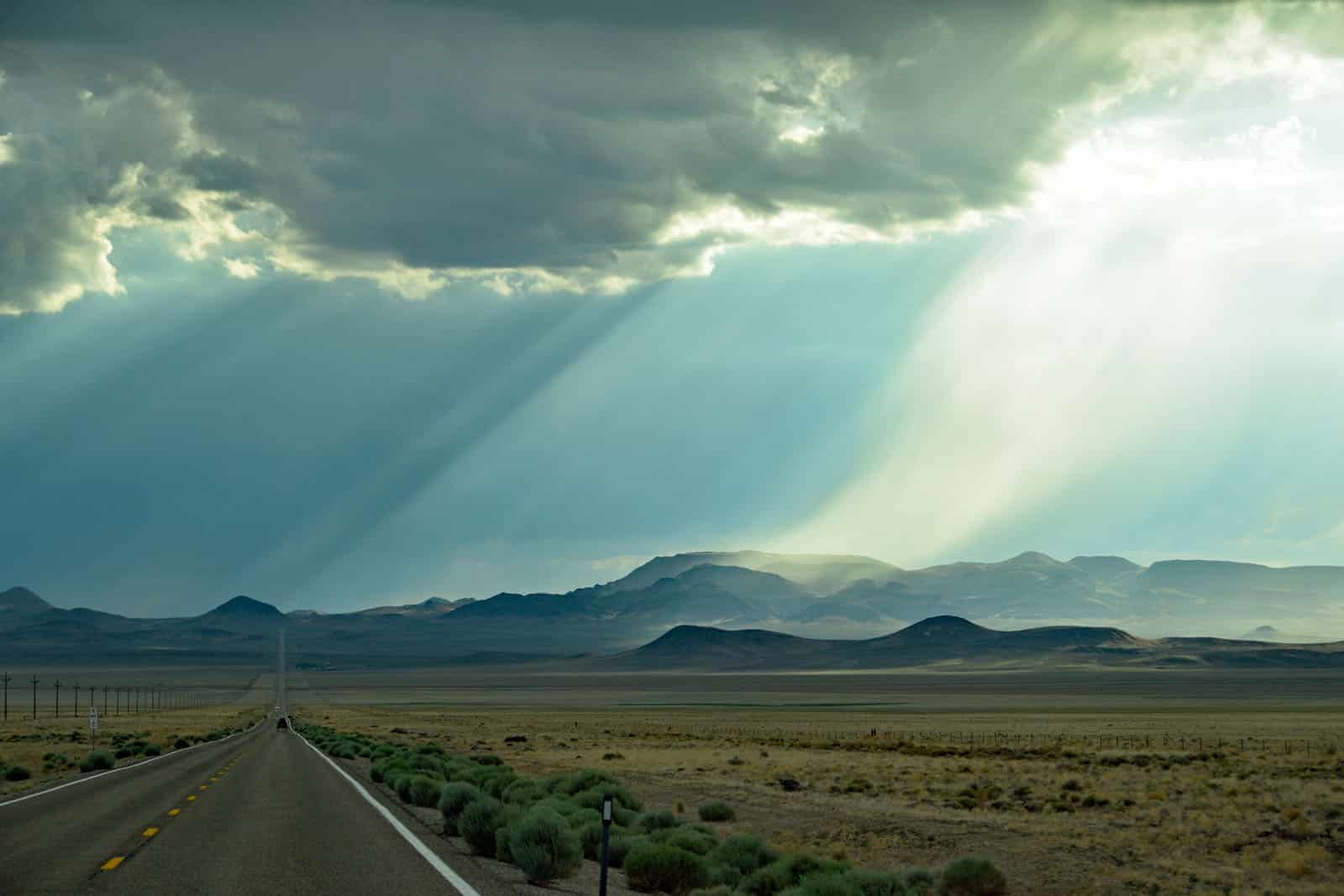
I also can’t confirm seeing any evidence of aliens on this route, but what I can say is that it was one of the most starkly beautiful and remote sections of road we experienced on this trip, made even more dramatic by the presence of distant storm clouds and lightning throughout the afternoon and evening. As we skirted Basin and Range National Monument on one side, and Nellis Air Force Testing Range on the other, the town of Rachel suddenly appeared as one of the only settlements for many miles. This quirky town of about 50 people specializes in all things alien-themed, and is yet another stop for those who love all things odd and unusual.
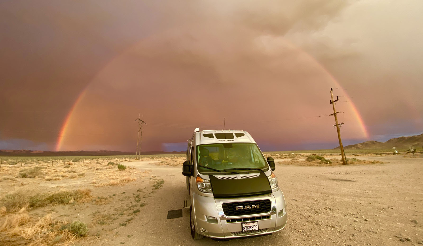
Tonopah
After a long day of driving, we arrived in Tonopah by evening, and made camp just outside of town at a remote rest stop that allows overnight stays. It was there that we experienced a sunset rainbow that was the ultimate capper to an extraordinary journey over the Extraterrestrial Highway. We may not have seen a flying saucer, but this light show over our van was the next best thing.
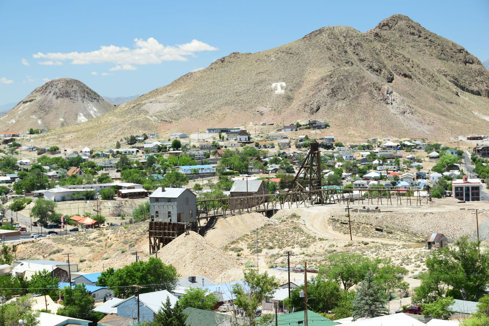
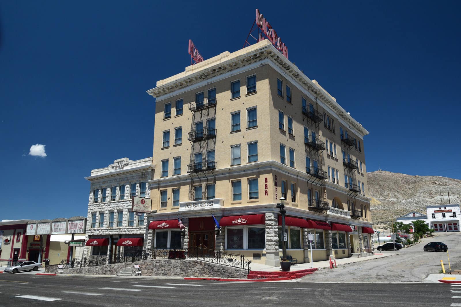
Nicknamed “Queen of the Silver Camps” for its rich mining history, Tonopah is located in a remote spot approximately midway between Las Vegas and Reno, and is more than 200 miles from either one. Selected as one of the “Top 10 True Western Towns” by True West magazine in 2019, this place immediately captivated us as we drove through it for the first time. The downtown district was graced with historic buildings like the circa 1907 Mizpah Hotel, named after the nearby mine, and the circa 1906 Belvada Hotel, originally built as the Nevada State Bank and Trust. Meanwhile, up on the hills looming above the town was all kinds of evidence of mining activity, like tall headframes, hoists, tunnels, trestles, open pits, and old mining equipment scattered about. When I learned that the old mine complex was actually the Tonopah Historic Mining Park, I knew we had to return the next day to explore this fascinating place.
After spending the night at Miller’s rest stop (a former town site on the Tonopah and Goldfield Railroad line), just outside of Tonopah, and experiencing the dramatic orange skies and rainbows of that evening, we returned to Tonopah the next morning to explore the town and its mining park. The Tonopah Historic Mining Park is located on the site of the original mining claims that started the rush to Tonopah in 1900. Although it was another hot day in Nevada, we spent over 3 hours exploring this historic mine site, including time spent in the museum, and also a climb to the highest point, the North Star Mine, with its commanding view over the entire scene.
It struck me as extraordinary that an abandoned mine operation of this size could still exist, decades after it ceased operations, taking up so much land in the town. In more populated and dense places like the Bay Area, you could never have this much open land (113 acres) sitting right along the downtown area, with such a relatively low-revenue operation as people paying $5 each to tour the grounds ($3 for seniors). But out here, the land values and demand for space is such that an operation like this is feasible. For anyone interested in history and “True West” towns, Tonopah, Nevada, is highly recommended.
Taking the long way home
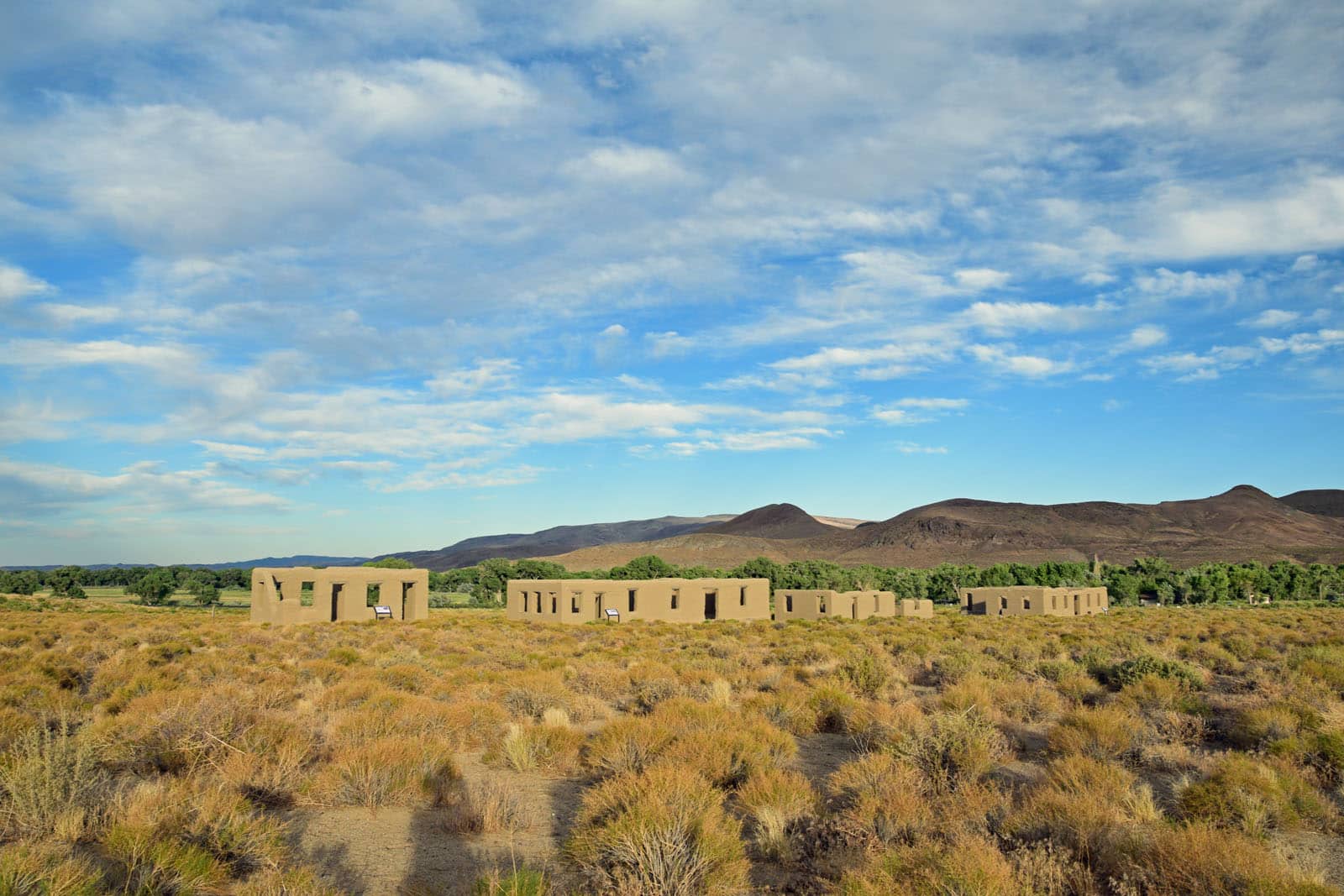
At this point, we still had more than 440 miles and two days to get home. It had been an absolutely fabulous trip, and the more southern route—even with its hotter temperatures—had been such an adventure and so worth it. We had a couple of long driving days ahead of us, and would spend a night at Fort Churchill State Historic Park, near Silver Springs, Nevada, along the way. That would take us about halfway home, and then we’d cross the Sierra Nevada range the next day on Highway 50, a return to the transcontinental route whose “Loneliest Road in America” section formed the backbone and theme of this trip.
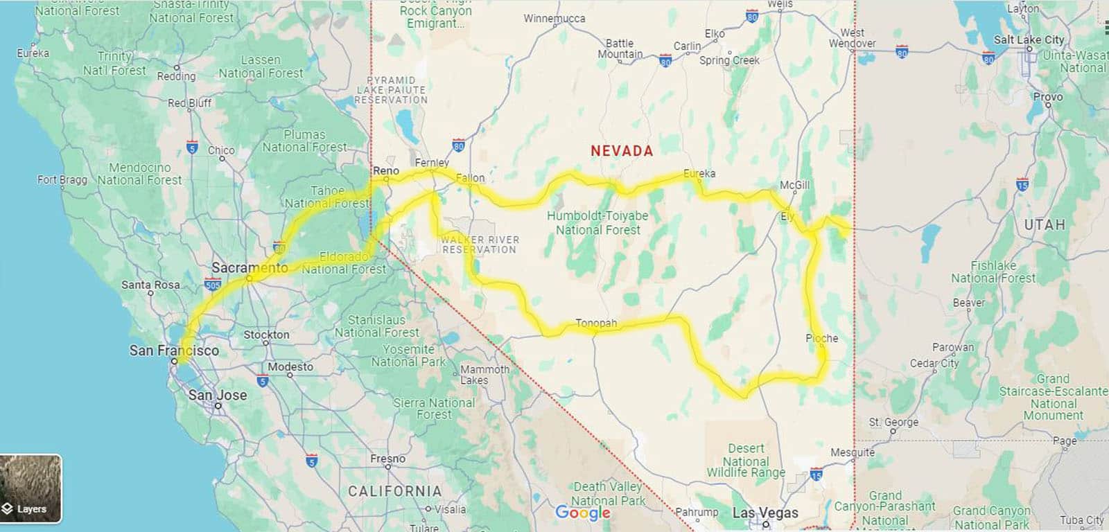
Although we had left Highway 50 near Great Basin National Park in the east, the way back west on Nevada’s other great highways was just as spectacular. This 1,500-mile loop turned out to be one of the great American road trips, and it came together via both a process of planning and spur-of-the-moment decisions. When traveling, it’s good to have a well-researched plan in place, but also to be open to changes on the fly, since that’s where some of the best stuff often is discovered.
It’s hard to say what my favorite part of this trip was, but perhaps the best part of any road trip is simply being “on the road” and anticipating what’s around the next bend or over the next mountain pass. Usually, it turns out to be much more than you were imagining.
Contributing writer Steve Gorman has been a resident of Alameda since 2000, when he fell in love with the history and architecture of this unique town. Contact him via [email protected]. His writing is collected at AlamedaPost.com/Steve-Gorman.

